Today is Anzac Day, in remembrance of the men of New Zealand and Australia that fought and died in war, originally commemorating the lives of those that landed at Gallipoli in WWI. There were many dawn services held this morning, but we had our own way of paying our respect - by making the Tongariro alpine crossing and summiting Mount Tongariro itself.
The first impression of the mountain is the imposing conical peak of Ngaurahoe, which is technically a cone of Mount Tongariro and not a separate mountain. Also in the park is Mount Ruapehu, which today was capped with snow and in winter is a popular ski-field.
 |
| Mt. Ruapehu |
Given the exposed and changeable conditions on the mountain, it is wise to start early and be down before the wind can blow in any troublesome cloud. The journey is a one-way route, leading between Mounts Tongariro (1978m) and Ngauruhoe (2291m), so it is necessary to have someone pick you up at the other end. In our case, a shuttle did the honours and we joined three New Zealanders - one of whom had made the crossing several times before and acted as our guide - to wait in the 6am darkness.
Our party was seven strong, which is only two shy of the nine members of the Fellowship of the Ring. The comparison is not as obtuse as it first appears, as Peter Jackson chose Tongariro as the model for Mount Doom in Mordor for his Lord of the Rings films. Ngauruhoe provided inspiration for the fictional volcano, but could not be filmed directly, as it is held sacred by the Maori.
The route along the pass is a 19.4km crossing by way of the ridges around the many craters formed by eruptions. Our journey started at the foot of the mountain, where a boardwalk elevated us from the frosty ground.
 |
| First light and frost |
First light soon broke and shone on the mountain peak. We presently found ourselves at one of the hardest parts of the climb - a 200m ascent over ancient lava flows, surrounded by lumps of black rock, known as the Devil's Staircase.
 |
| Mt. Ngauruhoe |
After the climb, we were rewarded with a plateau across the South Crater, before climbing to the lip of the aptly named Red Crater, which sports an enormous gash in its side, where tons of material was ejected. In the distance, we could see a blanket of white cloud making its way towards us.
 |
| Red crater |
As well as the peaks of the Tongariro, the weather was clear enough to see another volcanic mountain - the perfectly conical Mt. Taranaki, about 135km away as the crow flies.
 |
| Distant Mt. Taranaki |
At this location, we were at the highest point of the crossing (1886m), but had made good time thus far, so our guide recommended that we detour to the summit of Mt. Tongariro for a spot of lunch.
 |
| Three peaks |
We sat at the peak, munching on our predominantly peanut-based lunch. Aside from an egg mayonnaise sandwich, we had peanut butter sandwiches, peanuts (honey-roasted and salted), trail mix (containing peanuts), a cereal nut bar, and a peanut slab. And, of course, Anzac biscuits - delicious and homemade by one of our party.
It was good to fuel up and to lighten our load - all the water on the mountain is sulfurous, so we brought all our drinking water with us. The round trip to the summit added another 4km to the overall journey.
It was close to freezing at the summit, but felt a few degrees colder due to wind chill. As we walked into and out of the warm sunshine, we had to constantly layer up, strip down, put on and take off hats and gloves. We rejoined the trail, which had become much busier with latecomers who were not interested in the sidetrack to the summit.
 |
| Tongariro trail |
Behind us a blackened lava flow spread out into Central Crater and, as we made a sliding descent on the volcanic black sand, stunning views of the so-called Emerald Lakes opened up in front. The waters are each coloured a different shade of turquoise-green by the concentration of minerals in the surrounding rock.
 |
| Emerald lakes |
Our route continued past a large circular blue lake and over a ridge to North Crater for the long descent that wound our way down to the Ketetahi hut. The hut was rendered inoperable owing to damage by an explosion in 2012.
 |
| Route to Ketetahi hut |
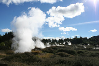
Given the lack of toilet facilities on the crossing, the two portaloos were seeing a lot of foot traffic. Greyish cloud mixed with the whiter steam rising from various fumaroles, however looking north we could still see out over Lake Rotoaira as far as Lake Taupo.
Having relieved ourselves, we continued the descent where the terrain suddenly changed to a forest environment. Emerging from the cover of trees, we reached our destination - a rather unprepossessing carpark full of other hikers and their pick-ups - at around 3pm.
We patted ourselves on the back as we took the bus home for a well-deserved hot shower and a few beers.